 ADSCivil
One toolset, one source of data, every documentation stage
ADSCivil is a Vietnamese-built BIM suite for infrastructure design, aligned with local standards and documentation practice. All modules share a single database, so a change in one place updates the drawings and quantities with it.
01 — Module suite
Choose a module by discipline

ADSCIVIL Intersection 2026
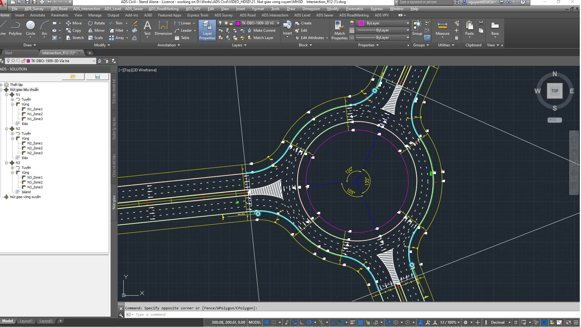
ADSCivil Intersection is an ideal intersection design solution for urban transport infrastructure projects, improving the quality of the works while optimising cost and time during construction.
What it does
- Supports turning and merging lane design to optimise traffic flow.
- Cuts design time by copying parameters between intersections.
- Gives flexible intersection design that is easy to adjust.
- Automatically produces contours and quantity estimates for construction.
- Supports 3D models and perspective export through presentation software.
ADSCIVIL VPV 2026
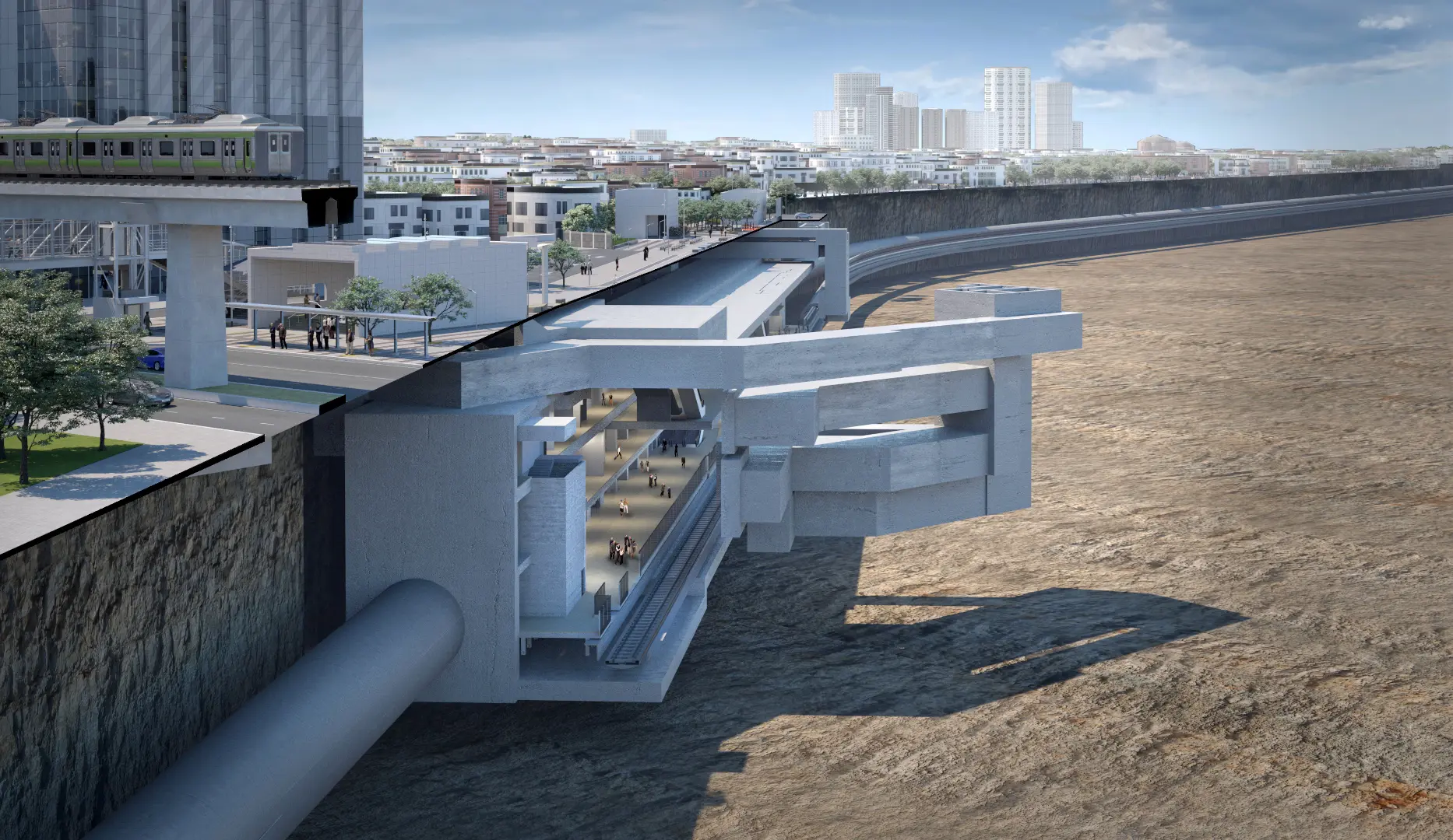
Builds fully automatic, accurate digital models from other design software and exchanges design content with the rest of the project team, so clashes are found while the design is still under way.
What it does
- Builds 3D BIM models quickly from ready-made templates
- Flexible, convenient team collaboration
- 3D models carrying asset information, bringing together models from several different packages
- Manages and displays models in real time
ADSCIVIL Roadmarking 2026
The first dedicated design tool in Vietnam for traffic management design and road safety design
What it does
- Design that safeguards road safety
- Produces existing-condition survey reports for the route
- Kept up to date with current standards

ADSCIVIL Level 2026
A dedicated tool for earthworks and level-planning design, calculating cut and fill quantities. ADSCivil Level runs on its own or alongside the other products in the ADSCivil infrastructure design suite.
What it does
- Earthworks calculation by the square grid method
- Earthworks calculation and checking by the 3D solid method
- Earthworks calculation by project acceptance stage
- Earthworks slope calculation

ADSCIVIL Sewer 2026
Professional drainage network design software for urban areas and industrial parks, covering every design stage:
What it does
- Manages a rich library of standard components
- Network-based drainage design and calculation
- Hydraulic calculation for stormwater and wastewater networks
- Level optimisation and synchronised design levels
- Map extraction for printing
- Splits culvert components into segments and exports 3D BIM models

ADSCIVIL Survey 2026
ADSCivil Survey is dedicated topographic survey software, providing a complete path from field data collection through to editing and issuing a full survey document set.
What it does
- Accepts input from several survey methods - point cloud, coordinates, CAD - with flexible survey area division.
- Corrects and updates measurement errors quickly, saving field costs.
- Builds triangulated terrain meshes using multi-threading, with clear display by elevation and slope direction.
- Paginates automatically, supplying standard frames and display control to suit any print scale.
- Keeps survey data in step, supporting surface design and earthworks planning.

ADSCIVIL Road 2026
ADSCivil Road is professional road design software offering a complete, optimised approach to designing every class of road, including expressways, urban roads, mountain roads and upgrading or rehabilitation works.
What it does
- Creates compound curves, handles superelevation to standard, and optimises transition sections.
- Keeps the drainage system in step and adjusts the layout flexibly as the project requires.
- Automates superelevation layout, keeping the subgrade stable and optimising sight distance on difficult alignments.
- Makes use of existing infrastructure, overlays the pavement and optimises grades.
- Integrates geotechnical data and quantities, supporting efficient construction and management.

ADSCivil IFC 2026
ADSCivil IFC: a visual 3D design solution for transport infrastructure works
What it does
- GIS integration: pulls terrain data from GIS in the Vietnamese VN2000 and WGS84 coordinate systems
- Visual 3D BIM design
- Rapid design of at-grade and grade-separated intersections
- Built-in Vietnamese standards
- 3D presentation
- Connects to the ADSCivil BIM ecosystem
ADSCIVIL VPV 2022
ADS VPV builds fully automatic, accurate digital models from other design software and exchanges design content with the rest of the project team, so clashes are found while the design is still on the drawing board.
What it does
- Rapid 3D design and modelling from ready-made templates
- Built for team collaboration
- 3D models carrying full asset information

ADSCIVIL Survey 2022
ADSCivil Survey supports the survey engineer end to end, from collecting field measurements through to a finished survey document set.
What it does
- Total station survey data
- Point cloud survey data
- Survey data digitised from cadastral maps
- Survey data converted from CAD-based software (AutoCAD, MicroStation, etc.)

ADSCIVIL Road 2022
A professional design tool for road design, covering every stage of the design process
What it does
- Basic design
- Detailed design
- Construction drawing design
- As-built documentation

ADSCIVIL Level 2022
ADSCivil Level is a dedicated tool for earthworks and level-planning design, calculating cut and fill quantities. It runs on its own or alongside the other products in the ADSCivil infrastructure design suite.
What it does
- Planning grade direction design.
- Intersection earthworks design.
- Grade-break design with controlled start and end levels.

ADSCIVIL Sewer 2022
Professional drainage network design software for urban areas and industrial parks, covering every design stage:
What it does
- Basic design
- Detailed design
- Construction drawing design
- As-built documentation

ADSCIVIL Intersection 2022
ADSCivil Intersection inherits the alignment data already designed in ADSCivil Road directly, so the road data at the intersection always stays consistent.
What it does
- Design of turning and merging lanes for vehicles before and after they change direction
- Copying design parameters, which removes repetitive work when several intersections share the same layout
- Automatic output of intersection contours, quantity estimate tables and control point coordinate tables for construction
- Each intersection quadrant is treated as an independent alignment, making it straightforward to design and control the cross slope and the kerb level transition within each leg, as well as to calculate detailed quantities
02 — Workflow
Five steps, one flow of data
03 — Standards
Standards built in
- Alignment geometry
- AASHTO Green Book and FMW Nigeria 2013, by road class
- Applies
- Title blocks and sheet layout
- Consulting documentation conventions, configurable per office
- Applies
- Quantity schedules
- Design and cost-estimate templates
- Applies
- Drainage network hydraulics
- Urban and industrial-park drainage standards
- Applies
- Standard components
- Your own component library, fully editable
- Extendable
- BIM model export
- Exchange data with other modelling software
- Interoperable
04 — What users say
ADSCivil has a clear, well-organised data structure that is easy to work with; new engineers need only one or two weeks to get up to speed. Drainage and other technical infrastructure are designed on the same drawing and kept consistent on the same cross section, which makes everything easy to check and prevents quantities from overlapping between items. The model follows the current move towards high-accuracy information modelling.
- A wide range of features suited to mountain roads, expressways, road upgrading and rehabilitation, and urban infrastructure (covering very nearly every class of road). - Commands produce results quickly; the software is easy to use and quick to work with. - A large technical team that responds promptly and willingly. - 3D can be viewed directly while designing, which makes the work visual and immediate.
05 — Services
Beyond the software
 TWINMOTION RESSELER
Twinmotion is a real-time 3D architectural visualization software that easily creates standard or high quality 360° virtual reality images, panoramas and videos only in seconds. Twinmotion combines an intuitive, icon-driven interface with the power of the Unreal Engine for architecture, construction, urban planning and landscape professionals.
TWINMOTION RESSELER
Twinmotion is a real-time 3D architectural visualization software that easily creates standard or high quality 360° virtual reality images, panoramas and videos only in seconds. Twinmotion combines an intuitive, icon-driven interface with the power of the Unreal Engine for architecture, construction, urban planning and landscape professionals.
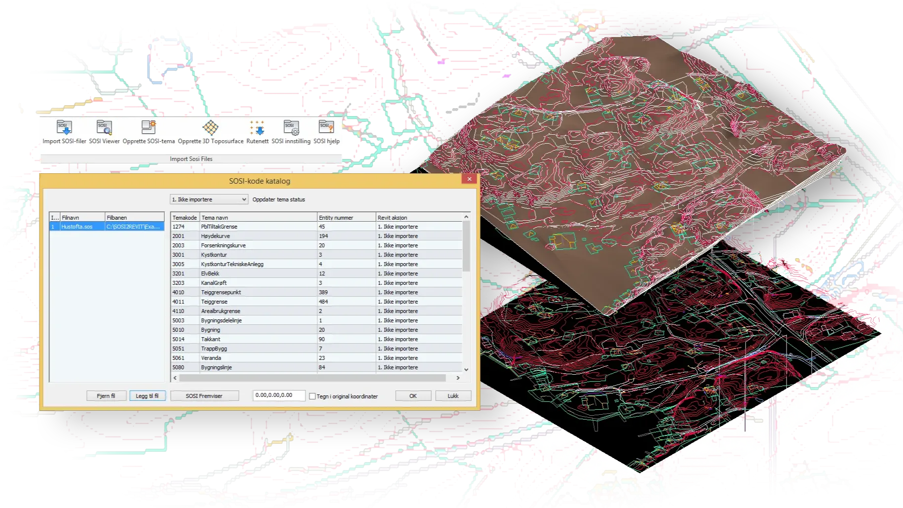 DEVELOPMENT OF BIM TOOLS BY ORDER
If you want to create automation tools, BIM tools, to optimize processes and current work, please contact us. With our high engineering experience and software development skills, we can take design consultant and provide perfect tools to increase work productivity.
DEVELOPMENT OF BIM TOOLS BY ORDER
If you want to create automation tools, BIM tools, to optimize processes and current work, please contact us. With our high engineering experience and software development skills, we can take design consultant and provide perfect tools to increase work productivity.
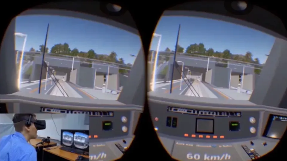 PROJECT PRESENTATION (FILM /VR/WEB)
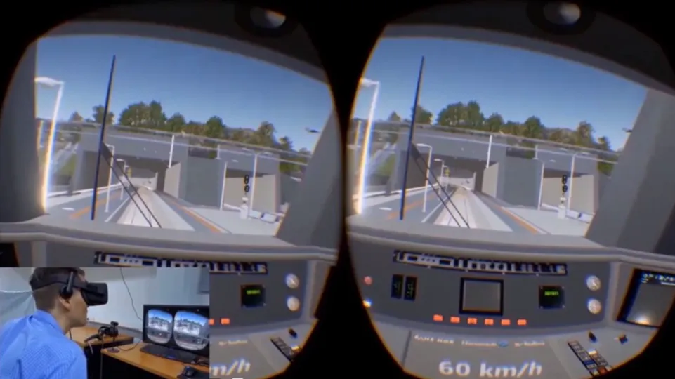
Projects related on highways and traffic infrastructure almost are large-scale projects that not only need to meet technical and economic criteria, but also have to be aesthetically pleasing. Therefore, the major local transport infrastructure always requires several expected architectural plans, thereby choosing the most optimal and aesthetic plan.
PROJECT PRESENTATION (FILM /VR/WEB)
Projects related on highways and traffic infrastructure almost are large-scale projects that not only need to meet technical and economic criteria, but also have to be aesthetically pleasing. Therefore, the major local transport infrastructure always requires several expected architectural plans, thereby choosing the most optimal and aesthetic plan.
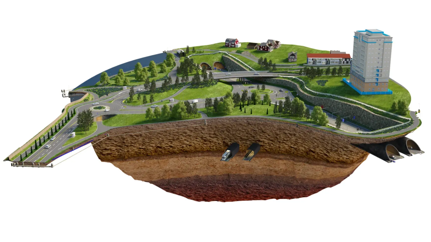 3D BIM MODEL OF WOOD INFRASTRUCTURE WORKS
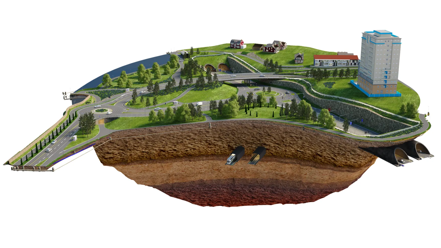
We provide modeling services for infrastructure works including: - 3D topography modeling from contour lines, Pointcloud... - 3D information modeling of highway including all elements: road surface, traffic signs, roadmarking... - 3D structure modeling on the route including bridges, tunnels... - Urban areas, landscapes modeling...
3D BIM MODEL OF WOOD INFRASTRUCTURE WORKS
We provide modeling services for infrastructure works including: - 3D topography modeling from contour lines, Pointcloud... - 3D information modeling of highway including all elements: road surface, traffic signs, roadmarking... - 3D structure modeling on the route including bridges, tunnels... - Urban areas, landscapes modeling...
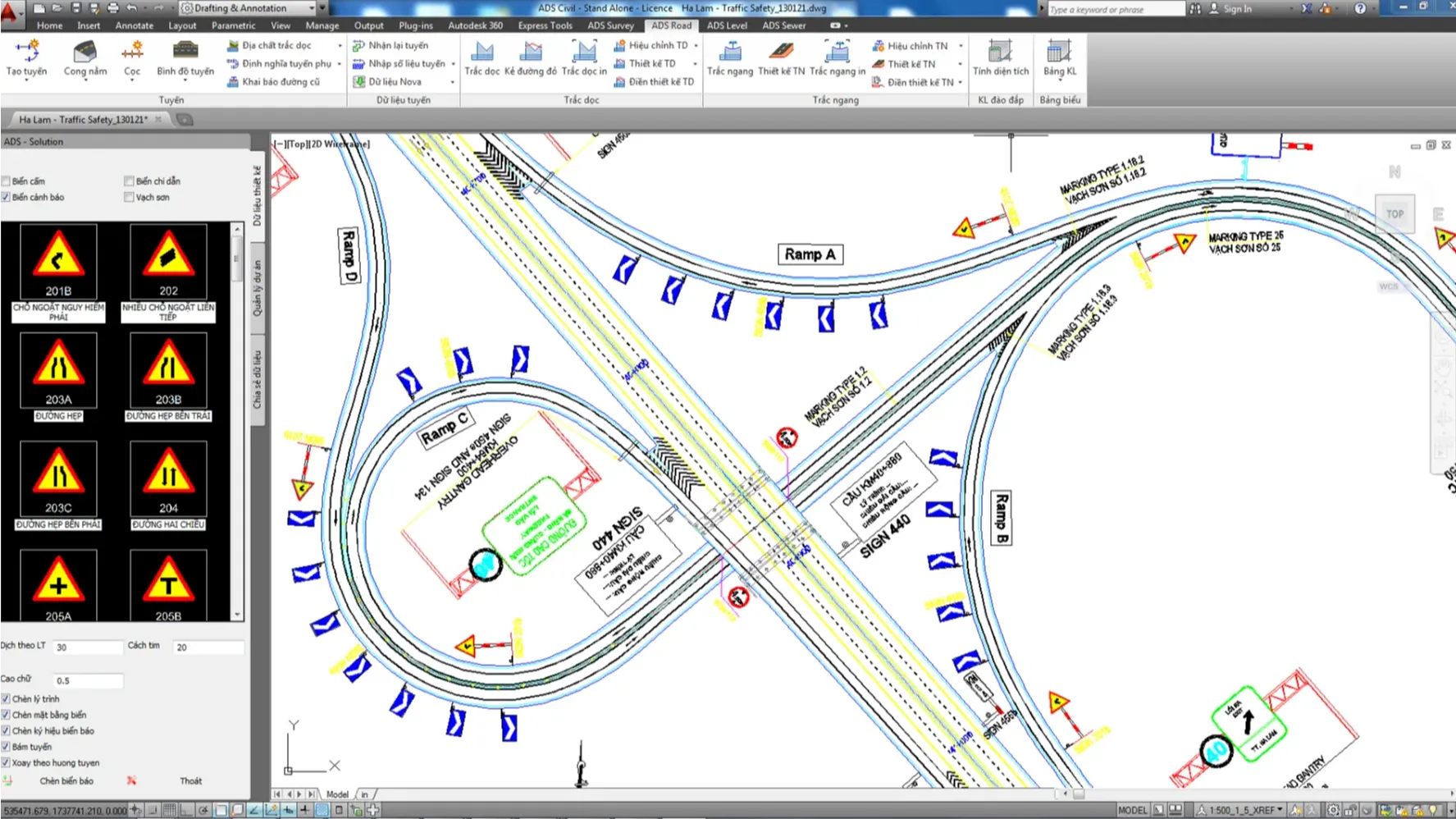 TRAINING ADSCIVIL SUITE
ADSCivil is combined by several modules covering topographic survey, basic design, detailed design, construction design and as-built drawing. ADSCivil creates 3D BIM models of infrastructure works, helping designers to significantly reduce errors in the design process, and bringing rapid progress as well as cost savings.
TRAINING ADSCIVIL SUITE
ADSCivil is combined by several modules covering topographic survey, basic design, detailed design, construction design and as-built drawing. ADSCivil creates 3D BIM models of infrastructure works, helping designers to significantly reduce errors in the design process, and bringing rapid progress as well as cost savings.
 ZWCAD SOFTWARE AGENCY
ZWCAD is a specialized CAD software product developed by ZWSOFT. It is compatible with most CAD software and supports DWG format that brings for a familiar experience.
ZWCAD SOFTWARE AGENCY
ZWCAD is a specialized CAD software product developed by ZWSOFT. It is compatible with most CAD software and supports DWG format that brings for a familiar experience.
06 — Pricing
Choose a configuration to suit your design team
Starter
Single module
For teams working in a single discipline: roads, drainage or earthworks.
- 01 module of your choice
- Per-machine licence
- Documentation and video tutorials
- Technical support during business hours
Alignment design set
The configuration most commonly used by transport consultancies.
- Survey · Road · Intersection · Roadmarking
- Data flows between modules
- Group training at your office
- Priority technical support
Complete
Full suite + BIM
All seven modules plus VPV, for organisations rolling out BIM across a whole project.
- 07 modules, no discipline limits
- VPV: model federation, clash detection, scheduling
- Component library standardised to your organisation
- Hands-on support through your first project
07 — News
ADSCivil news
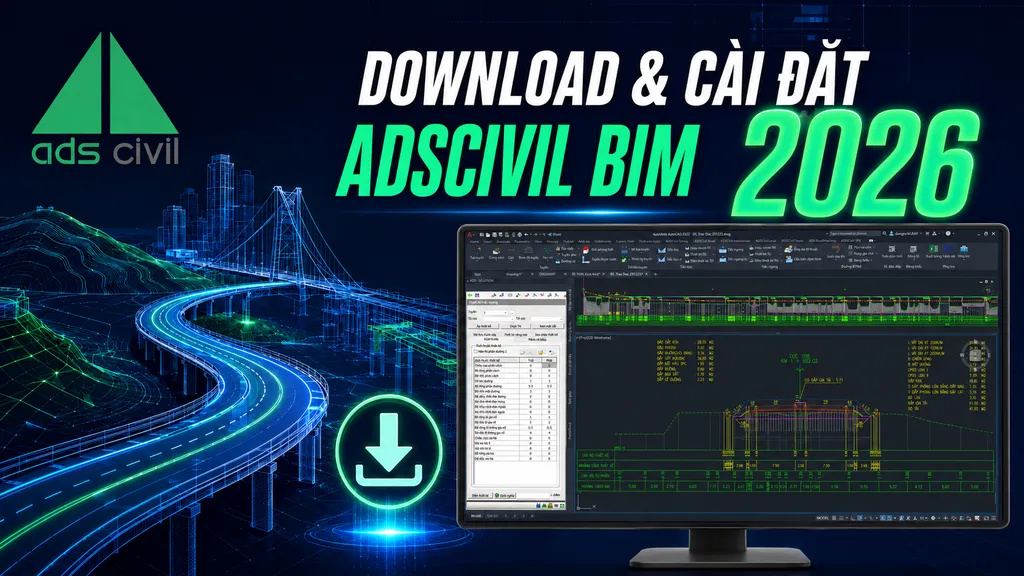 HOW TO DOWNLOAD AND INSTALL ADSCIVIL 2026 - IN DETAIL
How to download, install and activate ADSCivil BIM 2026 on AutoCAD and ZWCAD, and how to deal with the problems that come up most often during installation
HOW TO DOWNLOAD AND INSTALL ADSCIVIL 2026 - IN DETAIL
How to download, install and activate ADSCivil BIM 2026 on AutoCAD and ZWCAD, and how to deal with the problems that come up most often during installation
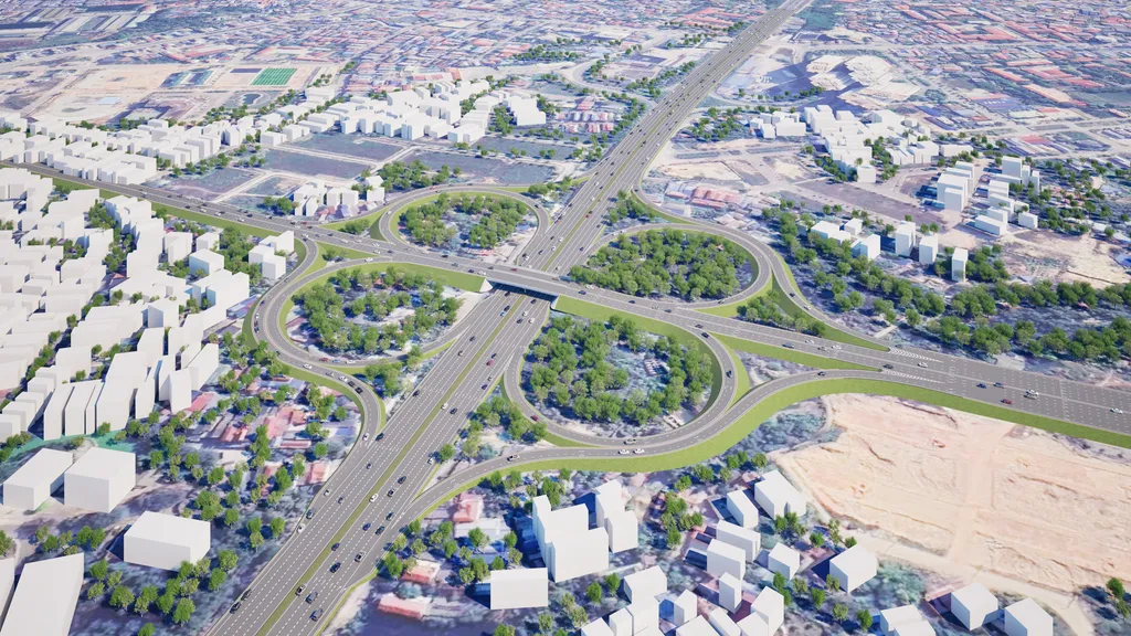 ADSCivil IFC - Infrastructure Concept
Supports the development of preliminary design options for transport infrastructure projects, saving time and cost and making design consultancy more effective
ADSCivil IFC - Infrastructure Concept
Supports the development of preliminary design options for transport infrastructure projects, saving time and cost and making design consultancy more effective
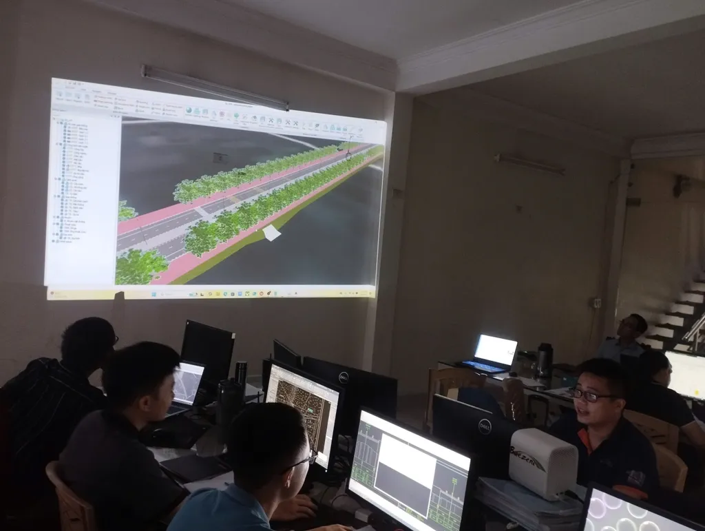 BIM MANAGER - COORDINATOR - MODELER TRAINING
Hands-on BIM training
BIM MANAGER - COORDINATOR - MODELER TRAINING
Hands-on BIM training
 TRY ADSCivil
Register for an ADSCivil trial
REGISTER AN ADSCivil ACCOUNT
How to register an ADSCivil account
REGISTER FOR A FREE ADSCivil 2026 TRIAL
Register for a trial of the ADSCivil transport infrastructure design suite
TRY ADSCivil
Register for an ADSCivil trial
REGISTER AN ADSCivil ACCOUNT
How to register an ADSCivil account
REGISTER FOR A FREE ADSCivil 2026 TRIAL
Register for a trial of the ADSCivil transport infrastructure design suite
08 — FAQ
Frequently asked questions
What does ADSCivil stand for?
ADSCivil is the name of the infrastructure design BIM suite researched and developed by Baezeni Software Co., Ltd. ADSCivil delivers maximum benefit to customers in cost savings, ease of use and improved quality of transport infrastructure design.
09 — Free trial
Get a trial version
Leave your details and our support team will issue a trial licence and guide you through installing it on the CAD platform you already use.