
×
![]()

COMPLETE GEOGRAPHIC MAP SOLUTION FOR ALL INTERNAL-EXTERNAL SURVEY
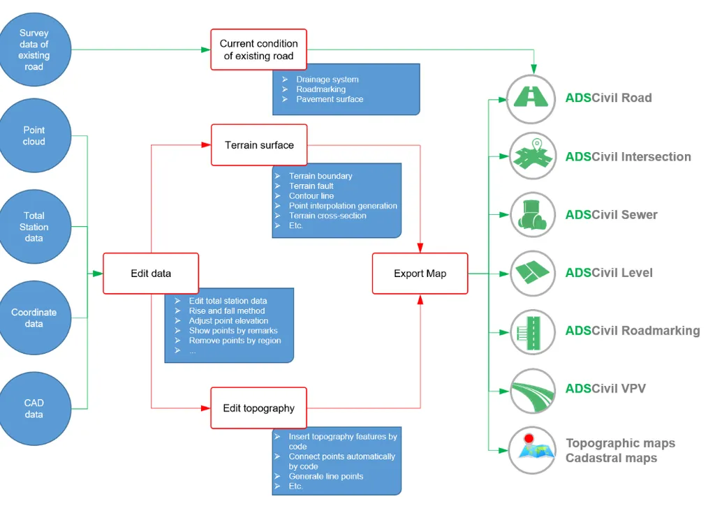
- Topographic survey work is fully supported for(from reading survey data to editing and exporting a complete report).
- All tasks are fully supportedso that users do not need to combine any other software. This ensures data consistency and security throughout the project implementation.
- The survey data processing is scientifically and logically designed. It provides not only the highest level of utility features but also simplicity and accessibility even for first-time users.
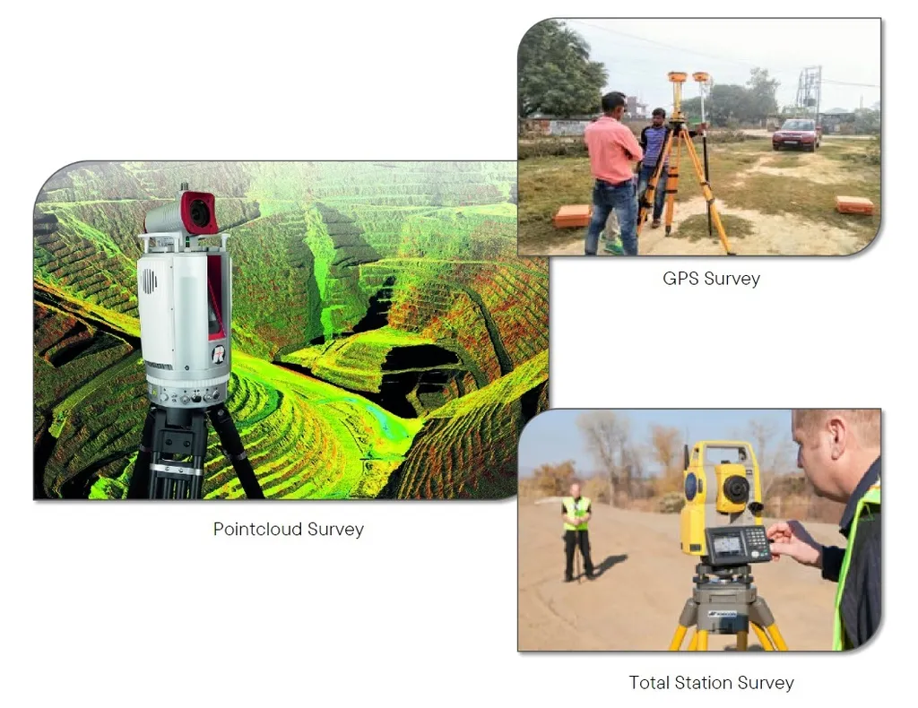
COLLECTING SURVEY DATA FROM DIFFERENT SURVEY METHODS
All different types of survey data can be edited and normalized for precisely and completely using in connection with each other:
- Pointcloud survey data.
- Coordinate survey data.
- Survey data digitized from cadastral map.
- Survey data converted from CAD software (AutoCad, Microstaion,etc.).
ADSCivil Survey supports the combination of different measurement methods. That allows the project survey area can be divided for many teams by using different devices. This ensures the maximum utilization of the human resources and can accelerate the project's implementation speed in which there is an urgent request on the schedule.
Survey data separation is also supported in many different ways. The user can choose to split each measurement method for each area or use multiple measurement methods for the same area.
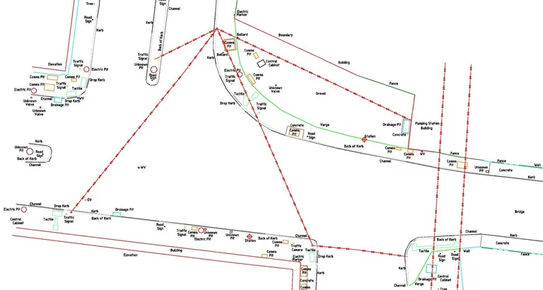
CREATING, CONNECTING TERRAIN - REREADING LOCATION ON THE MAP
With survey work, terrain connecting play a key role in accurately simulating the actual situation of the survey area. This important internal work is provided by ADSCivil Survey with a series of advanced features to improve map editing efficiency:
- Match points automatically according to the group of coding notes.
- Filter display of measurement points by group of coding notes.
- Insert features automatically according to the custom user-defined description coding table.
- Reference features from the road plan to longitudinal profile and horizontal alignment.
Having full information about current terrain such as houses, pagodas, etc. ensures that the design options are always optimal in terms of design boundaries.
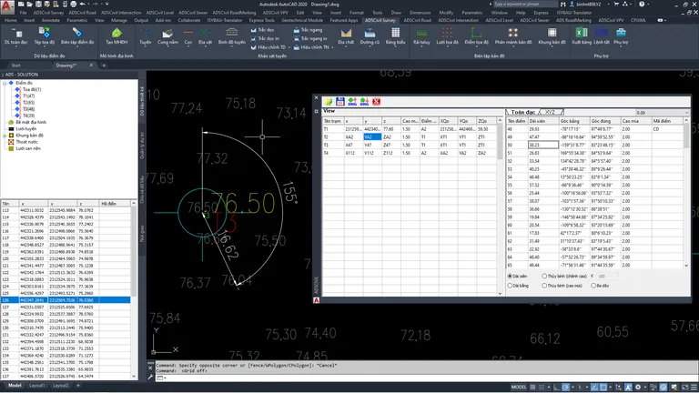
EDITING DATA
In the process of collecting measurement data, the data will often appear errors. For example, the errors occurred in measuring stations will lead to a series of errors in results of detailed points.
Instead of having to take measurements again in the field, which takes a lot of time and great expense, users can completely use the tools available in ADSCivil Survey to edit, process and reuse the data error.
- Transfer points between workstations.
- Update station coordinates and orientation points.
As mastering the data editing features in ADSCivil Survey, users can completely customize "turn off" the external tasks to revise by internal operations. It saves a lot of effort and costs for the field work and also contributes to speeding up the project implementation.
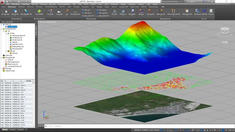
TRIANGLE MESH-BASED SURFACE MODELING
The Triangle Mesh-Based Surface Modeling, considered as the central processing unit of ADSCivil Survey, can fully and accurately represent all types of terrain encountered in reality.
- Process millions of elevations at high speed.
- The update feature which automatically updates the terrain display and contour lines as soon as terrain adjustments are made, from small adjustments (e.g., edge flips) to large adjustments (e.g., changing terrain construction base objects).
- Fault lines and contour lines provide the most accurate representation of the actual situation.
- Visually display the terrain in a high-color range, making it easy to identify false elevation points through color.
- Displays the slope direction of the terrain, which is an important basis for watershed division and drainage calculation.
The terrain grid supports a variety of base objects including ADSCivil objects and AutoCad basic objects (line, text, point, block, 3Dface, etc.)
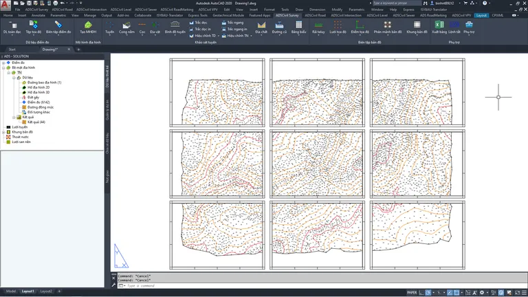
PROFESSIONAL MAPPING TOOL
ADSCivil Survey provides a standard frame template for both topographic and cadastral maps, fully meeting the requirements for many different users.
Display density can be controlled to allow that the user can export multiple maps with different scales only by drawing large-scale maps.
Map paging now is done automatically in ADSCivil Survey. It saves a lot of time, especially as export many different map scales. It's much more efficient than before that map paging was often done right only on the view model.
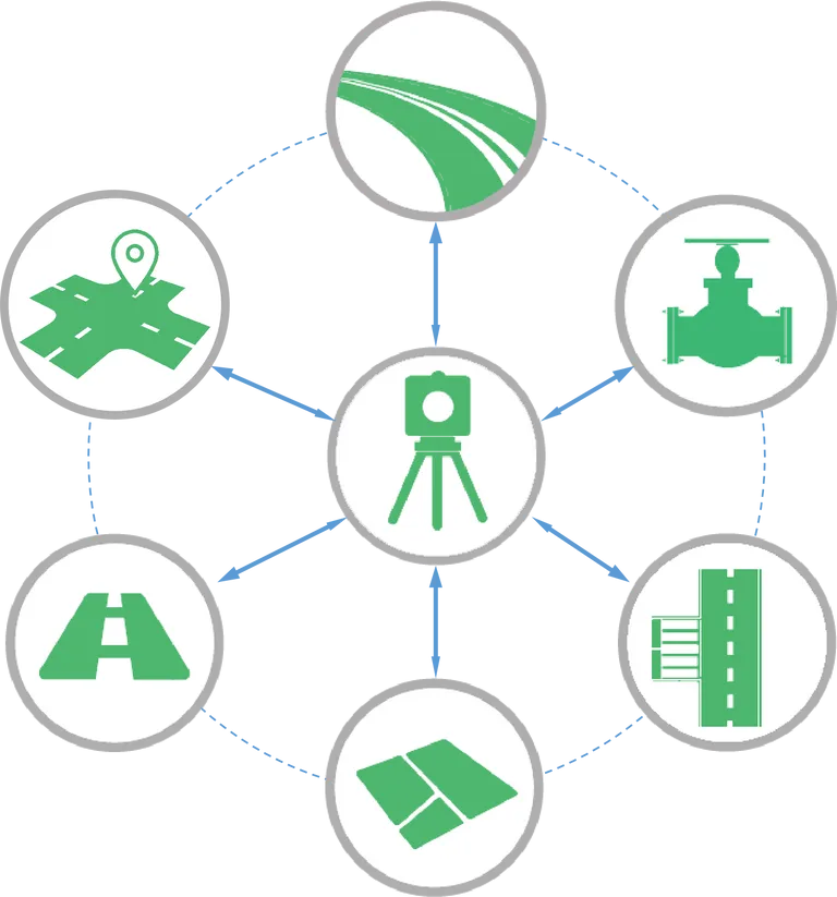
BASIS FOR ADSCIVIL ECOSYSTEM
ADSCivil Survey not only provides digital maps as a basis for other design software in the ADSCivil software ecosystem, but also works closely with them to build completed surfaces of construction:
- To create the design surface of construction: The design surface will take the data outside the design boundary, which is the current data combined with the design data within the design boundary.
- To create the surface plan for leveling design.
Pricing
Choose a service package that suits your requirements and budget, from flexible daily solutions to long-term investments
Other products
Expand your vision, elevate your project with a comprehensive toolkit for every construction challenge.